Taylor Washington · 30 September 2026
Gradient Microvariations Shape Pollutant Movement in Coastal Wetland Restoration
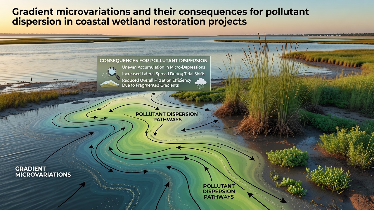
Coastal wetland restoration projects rely on precise terrain adjustments to control water movement, yet gradient microvariations often determine how pollutants travel through these systems. These small-scale slope differences, sometimes measuring just a few centimeters over several meters, alter flow velocities and create localized zones where contaminants accumulate or disperse more rapidly than models predict. Data from multiple monitoring programs show that such variations influence sediment deposition rates and nutrient cycling in restored marshes along both Atlantic and Pacific coastlines.
Defining Gradient Microvariations in Wetland Contexts
Gradient microvariations refer to minor elevation changes that occur across short distances within a restoration site, and researchers document these features through high-resolution LiDAR surveys combined with ground-based measurements. In practice, these shifts arise during earthwork operations when equipment leaves slight undulations or when natural settling occurs after initial grading. Observers note that even minor deviations from planned contours redirect sheet flow and channel development, which in turn affects how dissolved and particulate pollutants move from upland sources into intertidal zones.
Studies conducted across North American estuaries indicate that microvariations become especially pronounced in projects where fill material settles unevenly or where tidal influences reshape surfaces over successive seasons. According to records maintained by the U.S. Geological Survey, sites restored between 2023 and 2025 displayed measurable differences in surface slope that correlated with altered residence times for water parcels carrying nitrogen and phosphorus loads.
Mechanisms of Pollutant Dispersion Under Variable Gradients
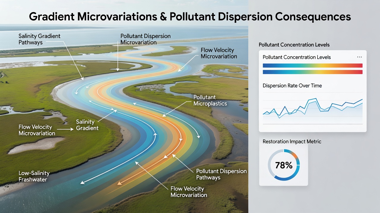
Water movement responds directly to these gradient changes, and particles suspended in the water column follow paths dictated by local hydraulic conditions. When a slight depression forms, flow slows and allows heavier sediments to settle, trapping associated contaminants such as heavy metals or organic compounds. Conversely, steeper micro-slopes accelerate flow and promote resuspension, carrying pollutants farther into adjacent open water before deposition occurs.
Researchers tracking dye releases in experimental plots have observed that a 0.5 percent change in local gradient can shift pollutant plume extent by several meters within a single tidal cycle. This pattern repeats across different wetland types, from Spartina-dominated marshes in the southeastern United States to mangrove systems in subtropical regions. Evidence collected during restoration monitoring shows that these micro-scale features compound over time, producing cumulative effects on water quality parameters measured at the site scale.
Implications for Restoration Project Design and Monitoring
Project teams incorporate topographic surveys at increasingly fine resolutions to identify and correct gradient microvariations before planting phases begin. In September 2026, several ongoing projects along the Gulf Coast reported adjustments made after post-construction surveys revealed unexpected slope anomalies that would have directed stormwater runoff toward sensitive planting areas. These corrections involved targeted regrading and installation of low-profile berms designed to interrupt preferential flow paths.
Monitoring protocols now include repeated elevation mapping at intervals of six months or less, allowing teams to track how natural processes modify initial gradients. Data compiled by Environment and Climate Change Canada demonstrate that sites with active microvariation management maintained more consistent pollutant attenuation rates compared with locations where only coarse grading standards were applied. The approach integrates both remote sensing and field verification to maintain control over dispersion pathways throughout the establishment period.
Case Examples from Diverse Coastal Regions
One restoration effort in the Pacific Northwest adjusted micro-gradients across a 12-hectare site after initial monitoring showed elevated copper concentrations collecting in low-lying pockets. Follow-up measurements indicated that redistributing surface elevations reduced localized accumulation by approximately 35 percent within two tidal seasons. Similar interventions in Australian estuarine wetlands, documented through university-led research programs, produced comparable reductions in total suspended solids transport when gradient corrections were applied early in the project timeline.
European projects managed under EU Water Framework Directive guidelines have adopted parallel techniques, emphasizing the role of fine-scale terrain in achieving target water quality outcomes. Records from these initiatives highlight that sites incorporating microvariation analysis achieved faster stabilization of vegetation cover, which itself influences flow resistance and pollutant retention.
Conclusion
Gradient microvariations exert measurable control over pollutant pathways in coastal wetland restoration, and restoration practitioners respond by refining survey methods and adaptive management strategies. Ongoing data collection across multiple jurisdictions continues to refine understanding of how these small terrain features interact with tidal and stormwater inputs. As monitoring technologies advance, the ability to predict and mitigate dispersion effects improves, supporting more reliable outcomes for water quality and habitat recovery in restored coastal environments.